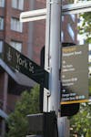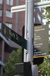

Legible Sydney Wayfinding Implementation
ASPECT Studios, in collaboration with Studio Binocular, were engaged by the City of Sydney to develop and implement the new “Legible Sydney” wayfinding system across an area of 25km². A framework was established to ensure the 600 signs, including 100 map pylons, were optimally located as part of a city-wide pedestrian network.
Detailed mapping included the illustration of 3D landmarks to assist in user journey-planning and an entirely new mapping of the southern part of the LGA. Meticulously designed sign templates resulted in the standardisation of large volumes of messaging, pictograms, transport information, destination times, mapping data and text–based information.
Read more +
- CLIENT City of Sydney
- TEAM ASPECT Studios, Studio Binocular
- INDUSTRIAL DESIGN (PYLONS) Tzannes for the City of Sydney
- LOCATION Sydney, NSW, Australia
- YEAR 2014-2016


Harmonizing these wayfinding systems across Sydney was essential in creating a seamless and coherent approach to implementation, ensuring information was accurate and responsive to current and future changes to transport and the public domain occurring across a rapidly changing urban landscape.
The final documentation packages totalled over 1500 pages of schedules, plans, visualisations, messaging schemes and finished artwork.
The final documentation packages totalled over 1500 pages of schedules, plans, visualisations, messaging schemes and finished artwork.


